
2014年02月27日
SL世界地図
先週水曜日のトレンザヨットクラブ練習は、外洋航海でした。
The meeting last week at Trenza Yacht Club was a long cruise.
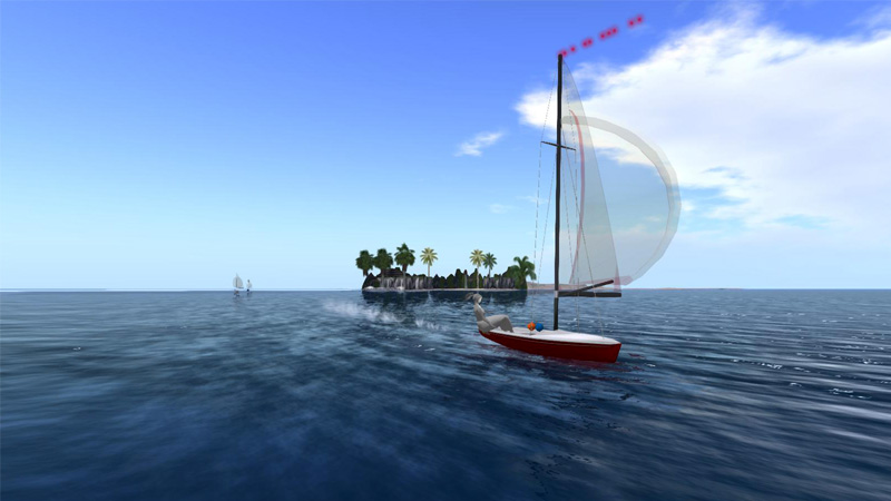
サトリ大陸の西岸を出てノーチラス大陸の内海へ。大きなクジラの骨のあるエイハブの島を通り、巨船タイタニックの横を抜け、東側へ出ます
南風10ノット設定で所要時間は約1時間! 途中で何度か落ちそうになりましたが、出走3艇のうち2艇が完走しました。
海岸に立ち入り禁止にしてしまったSIMがあり大陸一周できないのが残念です。リンデンさん、なんとかしてよ^-^
From the west shore of Satori continent, through the inland sea of Nautilus. Passing by the Ahub’s Haunt made of huge whale bones and giant Titanic, then sailed out into the east shore of Nautilus. It took about one hour on the south wind of 10 knots. Almost dropped on the way but two out of three of us managed to complete the course. It is too bad that there are some closed private SIMs on the shore line making it impossible to go around the continent. Linden, please do something.

昨年報告した世界地図です。その後変わってるかもけど好評だったので再掲します。
点々とあるのは独立したSIM、青く見える海のような部分には大陸周辺以外はSIMがないので入れません。
A world map of SL that I reported last year. There will be some changes since then but put it again here since that was received well. Scattered spots are independent SIMs. There is no SIM in the blue area like the ocean, so it is impossible to enter except limited area around continents.

SL世界の全体。白くなっている部分が上の大陸群です。
私が線で囲った部分はマップ上で少し色が変わっています。SIMを置くスペースなのでしょうか?
外洋航海に興味にある方は以前の私の記事を見てください^-^
大陸間航路:http://temisirbu.slmame.com/e1341207.html
長い航海:http://temisirbu.slmame.com/e1341602.html
The whole world of SL. The white areas are the continents shown above. What is the area surrounded by the lines I put? Could it be the area where SIMs can be set? If you are interested in ocean sailing, please see my earlier articles.


Posted by Temi at 06:05│Comments(0)
│ヨット